iCabbi API Integration
iCabbi API Integration
Optimizing fleet tracking and reporting
In today’s fast-paced taxi industry, accurate vehicle tracking and data analysis are critical for fleet management. Our software development team recently partnered with iCabbi, a leading Taxi Dispatch Platform, to implement an advanced iCabbi API integration. This integration allows for detailed tracking of each vehicle’s journey, capturing data in real-time across various stages—such as “waiting for dispatch,” “on route,” “with customer,” and “drop off.” With the iCabbi API, our client can monitor their entire fleet’s activity in unprecedented detail, improving operational efficiency and enhancing service quality.
Comprehensive Tracking with iCabbi API Integration
Our iCabbi API integration provided the tools to accurately monitor each stage of the taxi journey, gathering valuable insights into time, distance, and route specifics. By implementing iCabbi’s API, we ensured the client could track essential metrics throughout each phase of the journey, ultimately leading to better resource management and improved driver allocation.

Precision with Advanced Algorithms and Error Correction with iCabbi API Integration
High-level accuracy is vital when implementing iCabbi API integration in fleet management, so we applied advanced mathematical algorithms to verify data correctness and perform error corrections. These algorithms minimized GPS data discrepancies, fine-tuned vehicle status transitions, and ensured accurate mileage tracking. This precision gives our client a reliable record of every vehicle’s journey, helping them maintain an accurate operational overview.
Utilizing PostGIS and PostgreSQL for Geospatial Data Management
To support data persistency and facilitate geospatial calculations, we leveraged the power of PostGIS with PostgreSQL. This combination allowed us to manage location data efficiently, executing complex spatial queries for real-time mileage and route calculations. Through PostGIS, we ensured that data captured via iCabbi’s API could be stored, processed, and analyzed seamlessly, providing our client with precise tracking and location-based insights.
Generating Fleet Reports for Insurance Providers
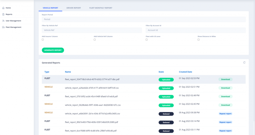
The iCabbi API integration allowed our client to generate detailed CSV and PDF reports based on the collected data, which were shared with insurance companies for accurate risk assessment. These reports contained crucial metrics such as vehicle mileage, trip data, and activity during each journey phase, providing insurers with verified information that supports more accurate fleet insurance policies.
Conclusion
Our comprehensive iCabbi API integration enabled our client to achieve high-precision tracking and accurate data reporting, transforming the way they manage and monitor their fleet. By combining iCabbi’s API with advanced algorithms and robust geospatial tools like PostGIS, we delivered an optimized solution that supports fleet efficiency, safety, and insurance compliance. If you’re looking to leverage iCabbi API integration for fleet tracking and management, our team has the expertise to make it a success.

